At the eastern end of Madeira, the island runs out of trees. What is left is a thin, bare ridge of volcanic rock, nine kilometres long, with the Atlantic on both sides and the wind pushing at your back.
That ridge is Ponta de São Lourenço, and the PR8 trail walks you along it. We did this hike, and it is our favourite coastal walk on the island.
This page is for you if you want a half-day hike with big sea views and no forest in sight. It also suits people based in the east, near Machico or the airport. If you hate wind, or you can’t handle full sun for a few hours, read the tips section before you book a slot.
Ponta de São Lourenço at a glance
- Where: the eastern tip of Madeira, in the parish of Caniçal, municipality of Machico.
- From Funchal: about 30 to 40 minutes by car to the start at Baía d’Abra.
- The trail: PR8 Vereda da Ponta de São Lourenço, about 4 km each way to Casa do Sardinha, so roughly 8 km there and back. Allow around 2 hours 30 minutes. Graded moderate.
- Booking and fee: at the time of writing (October 2026), you must book a 30-minute entry slot on the SIMplifica portal. Visitors over 12 pay 4.50€. Children 12 and under go free.
- Works: upgrade works began on 30 September 2026 and will run for at least 270 days, so about nine months. The trail stays open, with small marked detours.
- Bring: a hat, sunscreen, plenty of water and a windproof layer. Zero shade out there.
What you see on the PR8
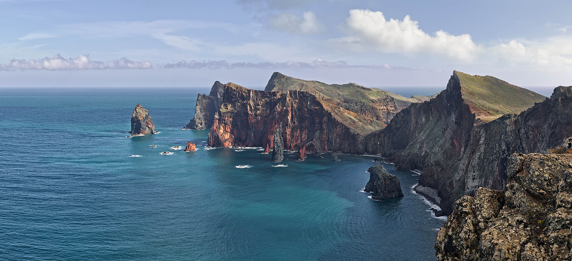
The peninsula is volcanic, mostly basalt, with a few pale limestone formations along the way. A semi-arid climate and the north wind keep the plants low, so the whole walk feels nothing like the green laurel valleys you see in the rest of Madeira.
And that contrast is the point.
The cliffs and the two coasts
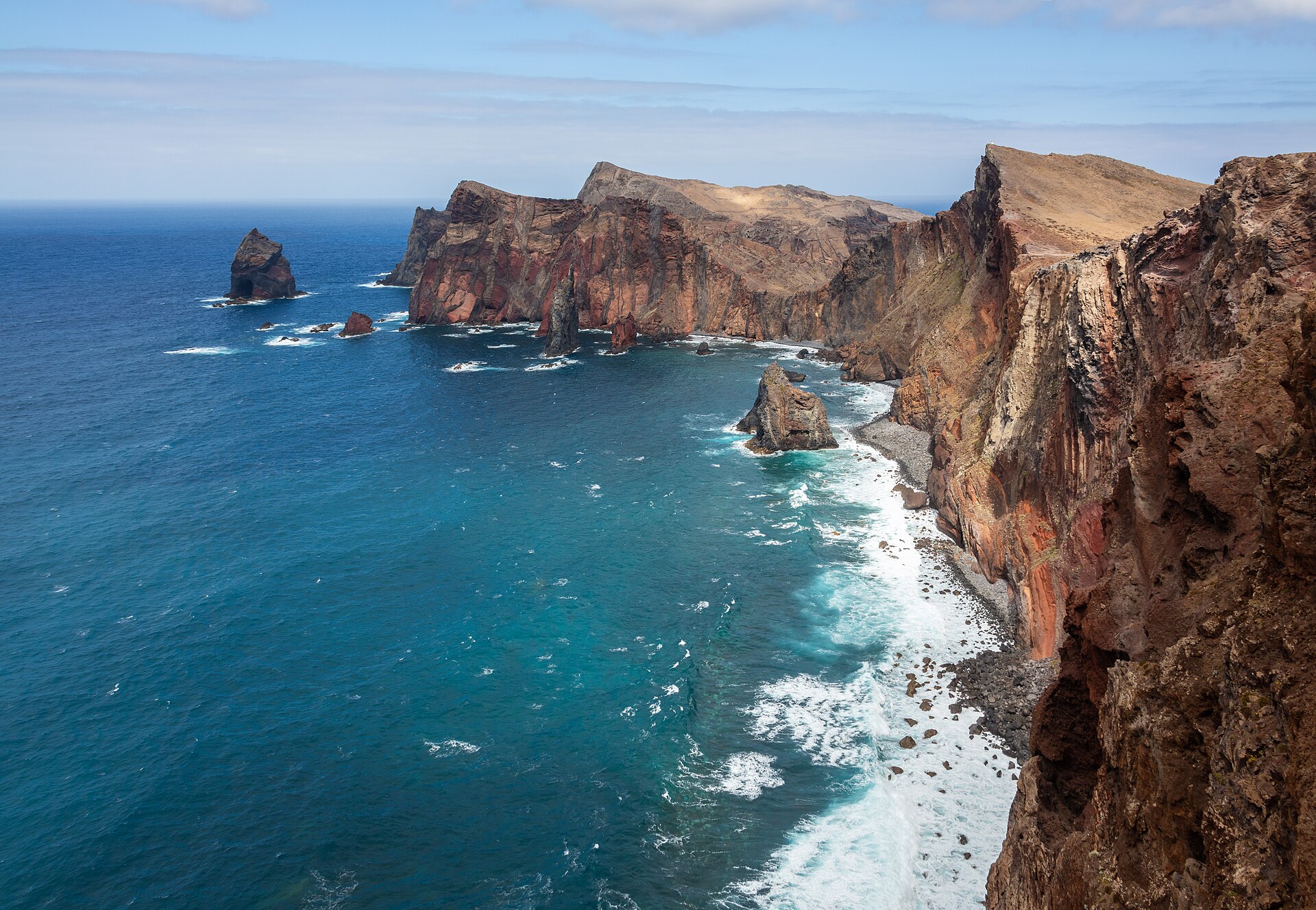
For most of the walk you look down on both sides of the island at once. The north side drops in steep, layered cliffs, cut by basalt dykes that stand out like dark walls in the rock.
Some stretches follow the edge closely. Keep kids close and stay on the path, especially when a strong gust comes over the ridge from the north.
The islets and the lighthouse
The land does not end at the peninsula. Two islets carry on out to sea: the Ilhéu do Desembarcadouro, also called Ilhéu da Cevada, and the Ilhéu do Farol, with the São Lourenço lighthouse on it. On a clear day you can also pick out Porto Santo to the northeast and the Desertas to the southeast.
Seabirds and rare plants
It has been protected since 1982 and is now a Partial Nature Reserve. The peninsula shelters rare endemic plants such as Echium nervosum and Matthiola maderensis, plus one of the biggest seagull colonies in the region.
Protected seabirds nest here too, including Cory’s shearwater (cagarra) and Bulwer’s petrel (alma-negra). With luck, you’ll spot a Mediterranean monk seal in the water below. We wouldn’t count on it.
Casa do Sardinha and Cais do Sardinha
Casa do Sardinha is the only house on the peninsula and the end point of the official trail. It has a ranger post and, at the time of writing, a small café selling cold drinks and snacks, with paying toilets. Don’t build your day around it. Carry your own water and food anyway.
A short path drops to Cais do Sardinha, a small stone landing where people swim in clear water. Nobody watches the water there. Only go in if the sea is flat.
Pico do Furado
Behind Casa do Sardinha, a steep stair path climbs to Pico do Furado, the highest point of the peninsula. From the top you look straight down onto the lighthouse islet. It is short but hard on tired legs, and honestly it is the best view of the whole hike, so we’d keep a bit of energy for it.
Booking the PR8 in 2026
Since 1 January 2026, every classified PR trail in Madeira needs a reservation, and Ponta de São Lourenço is one of them. You create an account on simplifica.madeira.gov.pt, pick the PR8 and a date, then a 30-minute entry slot, and start your walk within that slot.
At the time of writing (October 2026), the rates are:
- 4.50€ per person over 12 for a single trail that you book yourself on the portal
- 3€ through a tour operator
- 9€ for a day pass covering two or more trails, PR1 excluded
- children 12 and under: free, but they still go on the booking
Residents of Madeira don’t pay, though they must still register on the portal and appear on the booking like everyone else. Add every person in your group to the reservation and keep the confirmation on your phone, as you may be asked for it on the trail. Walking without a valid booking can lead to a fine.
Slots have a fixed capacity. Book at least a day ahead. At the time of writing there is no clear refund policy for bad weather, so check the forecast before you pay.
How to get to Ponta de São Lourenço
By car
The trail starts at the end of the road past Caniçal, at the Baía d’Abra car park. Count about 30 to 40 minutes from Funchal. If you need wheels for the day, Discover Cars compares the rental firms at the airport.
Parking is the weak spot. The car parks near the start fill early, and later arrivals end up on the roadside, sometimes several hundred metres back. A 30-minute slot also means you need to be on time, so leave a margin.
Beat the coaches.
Just before the trailhead, the Ponta do Rosto viewpoint looks straight down the peninsula. It is a quick stop by car and a good spot for sunrise if you don’t want to walk in the dark.
By bus
SAM bus 113 runs from Funchal through Machico and Caniçal to Baía d’Abra. Departures are limited, so check the current timetable with SAM before you plan your day around it. Our airport to Funchal guide covers the buses from the airport.
By tour
Plenty of small-group tours pick you up in Funchal, Caniço or Machico and drop you at the trailhead. You walk at your own pace, then ride back. When the tour operator books your slot, the fee is 3€ rather than 4.50€, but check if it is included in the price.
Casa do Sardinha also has a boat service back toward town. It won’t take you back to a car left at Baía d’Abra, so it makes more sense if you came by tour or by bus. See our best Madeira tours for the ones worth booking.
Where to stay for São Lourenço
You don’t need to sleep at the tip of the island. Machico is the closest real base, with a sandy beach and the airport a few minutes away. It is the easiest place to wake up and be first in the car park.
From Funchal, it is a comfortable morning trip. Our general advice for the capital holds here too: stay 8 to 10 minutes on foot from the seafront, close to the bus terminals and the old town.
Live prices from Booking.com and other sites. Move the map or change the dates to compare.
Torn between bases? Our where to stay in Madeira guide compares every area, and the map on the home page shows them at a glance.
Tips and mistakes to avoid
- Start early. There is zero shade, and the middle of the day is the hottest and busiest time in summer.
- Pack for wind. It is almost always windy out here, even on a sunny day. A light windbreaker helps a lot, and so does a hat with a strap or one that sits tight on your head.
- Carry more water than you think. The café at Casa do Sardinha can’t be guaranteed, and the return leg is the hot one.
- Follow the detours. During the works that began on 30 September 2026, small diversions are marked with arrows. Stick to them.
- Check the trail status. Trails can close for safety in storms or after rockfalls. Look at the IFCN and Visit Madeira pages on the morning you go.
- Wear proper shoes. The path is in good shape but rocky and up and down the whole way.
Make a day of the east
São Lourenço fills a morning. After lunch in Machico, drive up the north coast to the glass floor of the Miradouro do Guindaste, then on to Porto da Cruz. Santana is further along the same road.
That’s a full, easy day.
If you want the east day placed in a full week, in the right order with the mountains and the west, our free Madeira 7-day plan lays it out. Book your PR8 slot first, then sort out a tour or a car.
FAQ
How long is the Ponta de São Lourenço hike?
The PR8 runs about 4 km each way between Baía d’Abra and Casa do Sardinha, so roughly 8 km in total. Count around 2 hours 30 minutes of walking. Add time for the climb to Pico do Furado and for a swim.
Do you need to book Ponta de São Lourenço?
Yes. At the time of writing (October 2026), you book a 30-minute entry slot on the SIMplifica portal and pay 4.50€ if you are over 12. Children 12 and under are free but must be added to the reservation. Madeira residents don’t pay but still register.
Is the PR8 hard?
It is graded moderate. The path is in good condition but goes up and down the whole way, with a steep stair climb at the end if you go up Pico do Furado. The real difficulty is the sun and wind, with no shade at all.
Is the trail open right now?
Yes, with conditions. Upgrade works started on 30 September 2026 and should last at least 270 days, and the trail stays open with small marked detours. Check the Visit Madeira trail page before you go.
Can you swim at the end of the hike?
Yes, at Cais do Sardinha, a small landing a short walk below Casa do Sardinha. The water is very clear, but there is no lifeguard and no facilities at the water. Only swim on a calm day.
Sources
- PR 8: Vereda da Ponta de São Lourenço (Visit Madeira)
- Ponta de São Lourenço (Visit Madeira)
- Cais do Sardinha (Visit Madeira)
- Everything You Need to Know About Hiking in Madeira in 2026 (Visit Madeira)
- Hiking in Madeira Now Requires a Reservation in Advance (Portugal.com)
- Vereda da Ponta de São Lourenço condicionada por nove meses (DNoticias)
- Ponta de São Lourenço (Wikipedia)
- PR 8: Ponta de São Lourenço (This is Madeira Island)
- PR8: Vereda da Ponta de São Lourenço HT (This is Madeira Island)
- São Lourenço Madeira: A Complete Guide to Hiking PR8 (Voyageur Tripper)
- Ponta do Rosto Viewpoint (Journey Era)
This guide contains affiliate links. If you book through them, we may earn a commission at no extra cost to you (disclosure).