Madeira’s story began on a beach in the east. In July 1419, João Gonçalves Zarco and Tristão Vaz Teixeira came ashore in Machico bay, about 20 minutes by road out of today’s Funchal, and the settlement of the island started there.
This side still feels nothing like the capital. The far east is dry and windy. Round the corner, the north-east coast turns green and steep, with a rock about 600 metres high standing straight out of the sea at Porto da Cruz.
We saw most of it on our trip, and it’s the half of the island we’d send hikers to first.
This page shows you how the east fits together, then points you to our full guide for each place. It suits walkers best, and anyone who wants a sandy swim close to the airport.
East Madeira at a glance
- Where: the eastern tip and the north-east coast, mostly in the municipalities of Machico and Santana, plus the central peaks above them.
- Drive times out of Funchal: about 20 minutes to Machico, 32 to the Baía d’Abra trailhead, 33 up to Pico do Arieiro, 35 to Porto da Cruz and 41 to Santana, traffic allowing.
- Main roads: the VR1 expressway runs east along the south coast past the airport and Machico and ends at Caniçal. The VE1 takes over for the tunnels up the north-east coast as far as Santana. The old ER101 follows the same coast too, but its tight bends and steep climbs through the valleys make it much slower.
- Best for: sunrise at Pico do Arieiro, a sand swim at Machico and a rum tasting at Porto da Cruz.
- Trail fees: at the time of writing (November 2026), 4.50€ for the PR8 and 10.50€ for the full PR1, for walkers over 12, booked on the SIMplifica portal.
- Bring: a windproof layer, even in August.
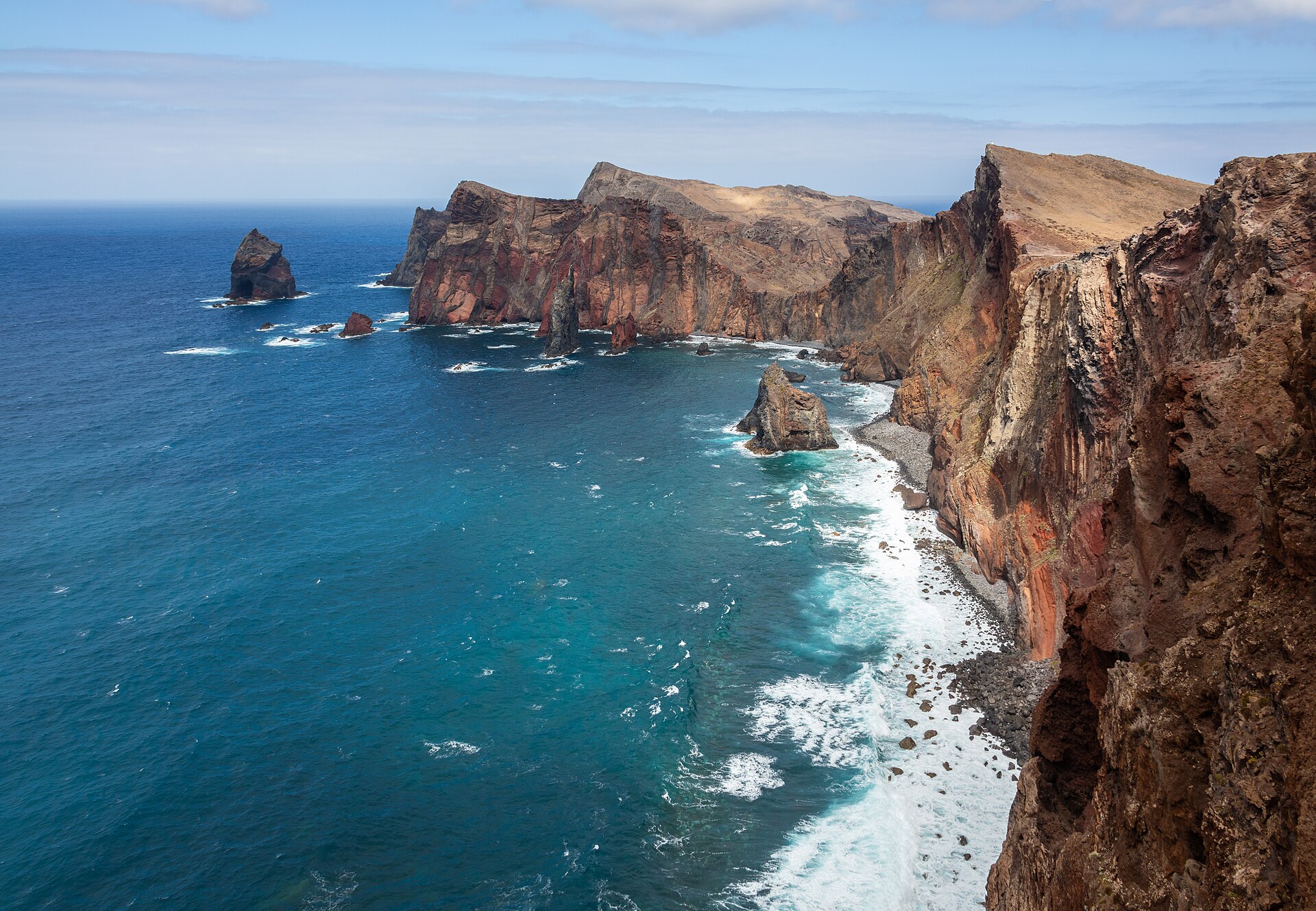
The far east
Machico
Machico sits around a wide bay, with planes dropping low over the water on their way into the airport. Its beach has golden sand imported from North Africa, which is rare on an island of pebbles and black stones.
We went, and we’d happily go back for the sand alone. After a swim, the old chapels and the 1419 landing story give you an hour of easy wandering. It is also the closest real base for an early start on the peninsula.
Ponta de São Lourenço
Ponta de São Lourenço is the island’s eastern tip, a bare volcanic ridge nine kilometres long and a Partial Natural Reserve. The PR8 trail runs about 4 km each way between Baía d’Abra and Casa do Sardinha. Count roughly 2 hours 30 minutes of walking, graded moderate.
We did it. It’s our favourite coastal walk on Madeira.
At the time of writing (November 2026), you book a 30-minute slot on SIMplifica. Upgrade works began on 30 September 2026 and are planned to last about nine months, so expect small detours marked with arrows. There is no shade at all, so start early.
The north-east coast
Cross the mountain north of Machico and the island changes colour. Higher cliffs, greener valleys. Clouds often sit on the ridges here while Funchal is in full sun, so check the north coast forecast before you cross.
Porto da Cruz
Porto da Cruz lies at the foot of the Penha d’Águia, or Eagle Rock. We took our selfie on the shore with the rock right behind us, and it looks unreal in person.
The village has two pools on the seafront promenade and a surf beach. Its rum distillery, Engenhos do Norte, was built in 1927 and still uses 19th-century machinery. Between March and May you can watch the cane being processed, and the tastings happen at the Casa do Rum next door. Keep Porto da Cruz for a clear morning, when the rock isn’t lost in cloud.
Miradouro do Guindaste
Round the Penha d’Águia and you reach Faial, where the Miradouro do Guindaste pushes two glass platforms out over the sea. We stood on the glass, and the view runs east along the coast toward Ponta de São Lourenço, with the Penha d’Águia in the middle of it.
On very clear days, Porto Santo shows on the horizon. Half an hour here is enough. The viewpoint was closed for works in 2026, so check its status on Visit Madeira before you go.
Santana
Santana is the town of the triangular thatched houses that end up on every postcard of the island. We took our photo in front of them. Twenty minutes is plenty.
The bigger reason to come is the walking. UNESCO named Santana a Biosphere Reserve in 2011, and its trails add up to more than 120 km. Pico Ruivo, the highest point of the archipelago at 1,862 m, is here too.
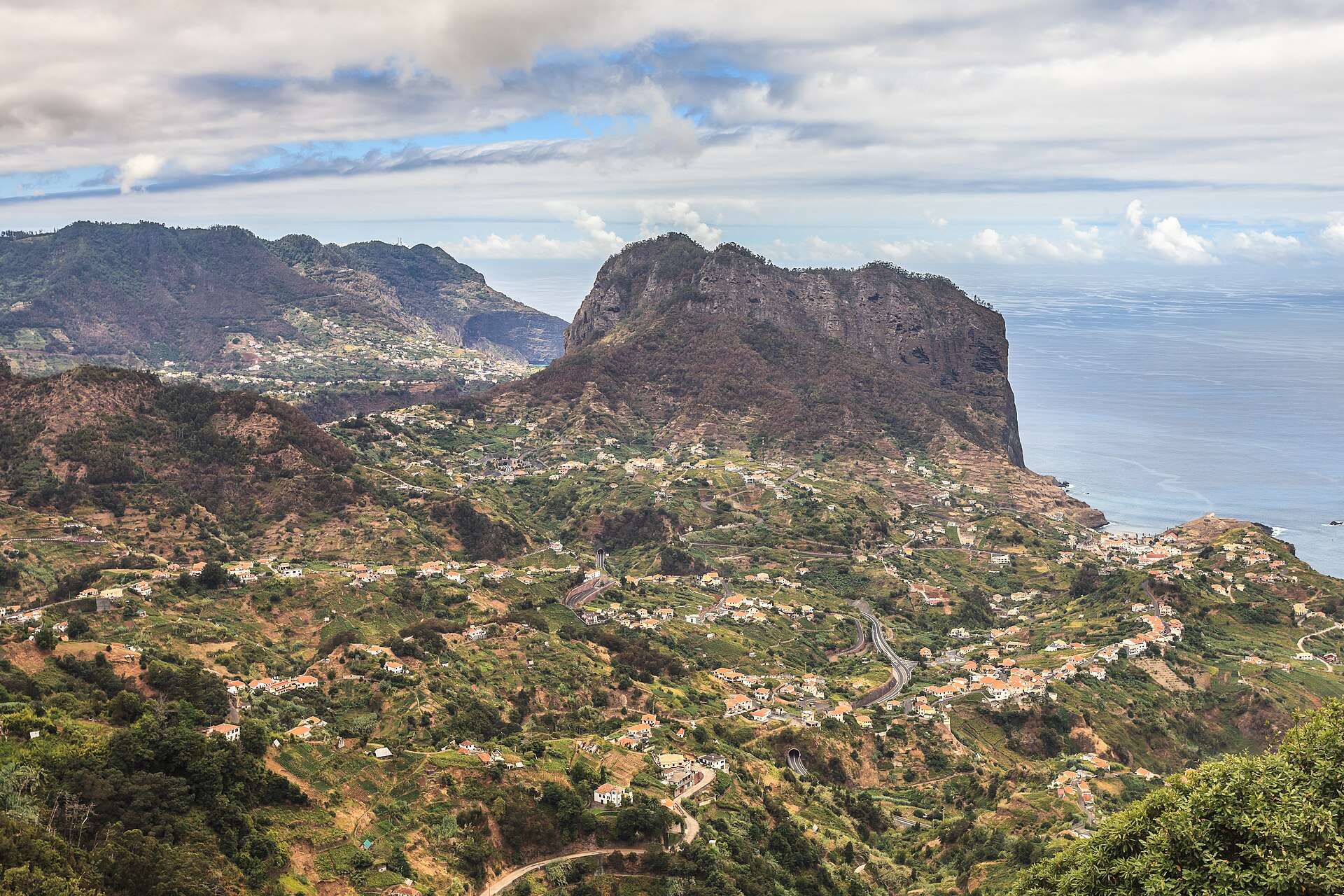
The peaks
Pico do Arieiro and Pico Ruivo
The PR1 between Pico do Arieiro and Pico Ruivo is the walk we’d plan a Madeira trip around. We hiked it, and we’d do it again tomorrow. The trail follows the ridge for 6.1 km one way, through rock tunnels and up long stairs, in about 3 hours.
Plan this one carefully. At the time of writing (November 2026), you need a timed slot on SIMplifica, and beyond the Pedra Rija viewpoint the route only runs one way, toward Pico Ruivo. The PR1 itself ends at Pico Ruivo. From there you walk down the PR1.2, 2.8 km to the car park at Achada do Teixeira, above Santana, far from any car left at Arieiro.
Sort out the ride back before you book the slot.
Public transport up here is close to non-existent, so book a taxi to meet you at Achada do Teixeira, or a transfer that drives you back to Pico do Arieiro. A guided hike solves it too, with drop-off at Arieiro and pickup at the finish.
How to plan your days
The trick on this side is to group places by coast, so you don’t keep crossing the mountain. These three days work in any order, but check the weather and give the clearest morning to the ridge.
Day one: the far east
Ponta de São Lourenço on an early slot, then Machico. Getting to Baía d’Abra early means a cooler walk on a trail with no shade, and a much easier parking spot. Drive back to Machico for lunch and an afternoon on the sand.
Day two: the north-east coast
Porto da Cruz in the morning, then the Guindaste at Faial, then Santana. Porto da Cruz and Santana are only about 15 minutes apart by car, so most of the day goes on looking rather than driving. Head back to Funchal on the expressway.
Day three: the ridge
An early PR1 slot at Pico do Arieiro, then the PR1.2 down to Achada do Teixeira. Have your taxi or transfer take you down to Santana for the houses in the afternoon if you skipped them on day two.
Short on time? Our Madeira itinerary fits the east into a 5, 7 or 10-day trip, and the car rental guide covers the mountain roads.
Getting around the east
By car
A car makes this side easy. The expressways and their tunnels do most of the work. If you rent, Discover Cars compares the rental companies at the airport, which sits right on the VR1 east of Funchal.
Parking is the weak point. The car parks at Baía d’Abra fill early, and late arrivals end up on the roadside. The Guindaste car park is small too, though spaces turn over fast.
By bus
Since 2024, all the island’s buses have run under one name, SIGA, which brought the old bus companies into a single network and ticket system. At the time of writing (November 2026), an intermunicipal ride costs 2.60€ in cash on board, and the Giro 24 visitor ticket costs 12.50€ for 24 hours.
At the time of writing, Machico gets a bus roughly every half hour, but frequencies change. Baía d’Abra and Santana see far fewer, and for the PR1 you should plan on a taxi or a transfer rather than a bus. Check the current timetables on siga.madeira.gov.pt before you plan a day around them.
By tour
Tours fix the two awkward bits of the east, the one-way PR1 and the thin bus service up the north-east coast. Look for an east tour that pairs Santana with Porto da Cruz and the mountain roads. Not all of them stop at the Guindaste, so read the list of stops before you pay.
Our best Madeira tours page compares the main types.
Where to stay on this side
Sleep in Machico if you want to be first in the car park at Baía d’Abra, or if you fly out early. The airport is only a short drive away, and our airport to Funchal guide explains the transfers if you land late.
Sleep in Santana if the ridge and the levadas are the point of your trip. The trailheads are close. The evenings are very quiet.
For everyone else, Funchal works fine as a base, since every town on this page is under 45 minutes away by car.
Live prices from Booking.com and other sites. Move the map or change the dates to compare.
Still choosing? Our where to stay in Madeira guide compares every base on the island.
Before you go
- Don’t judge the north coast by Funchal’s sky. Clouds often sit on the north-east mountains while the south coast is sunny, and the north side gets far more rain. Our best time to visit page explains the seasons.
- Book trail slots first. The PR1 and the PR8 both need a SIMplifica booking, and trails can close for weather or works at short notice.
- Read the sea. The north-east takes the open Atlantic head on, so swim in the pools at Porto da Cruz when the waves are big.
The east rewards an early alarm and a booked slot. If you’d like these days placed in a full week, in an order that keeps the driving short, our free Madeira 7-day plan lays it all out. Then book your PR8 or PR1 slot, and when you’re ready for sunsets instead of sunrises, our West Madeira guide covers the other end of the island.
FAQ
Is east or west Madeira better?
They suit different trips. The east has the two big hikes, the PR1 ridge and the PR8 peninsula, each about half an hour’s drive from Funchal. The west is further away and better for sunsets and the long north-west coast drive. With a week, do both.
How many days do you need for east Madeira?
Two days cover the far east and the north-east coast at a relaxed pace. Add a third day for the PR1, because it needs an early start and a ride back from Achada do Teixeira at the end. In a rush, Machico and the north-east coast fit into one long day.
Can you visit east Madeira without a car?
Yes, with some planning. SIGA buses reach Machico often, but Baía d’Abra and Santana get only a few a day. For the PR1 and the north-east coast, a tour or a transfer is far simpler.
Do you need to book hikes in east Madeira?
Yes. At the time of writing (November 2026), the PR8 and the PR1 both need a slot on the SIMplifica portal, at 4.50€ and 10.50€ for walkers over 12. Check the IFCN and Visit Madeira trail pages for closures before you go.
Sources
- Machico (Visit Madeira)
- Praia de Machico (Wikipedia)
- PR 8 Vereda da Ponta de São Lourenço (Visit Madeira)
- Vereda da Ponta de São Lourenço condicionada por nove meses (DNoticias)
- Penha d’Águia (Visit Madeira)
- Engenhos do Norte (Visit Madeira)
- Porto da Cruz Bathing Complex (Visit Madeira)
- Miradouro do Guindaste (Visit Madeira)
- Miradouro do Guindaste encerra dois meses (DNoticias)
- Santana (Visit Madeira)
- PR1 Vereda do Areeiro (Visit Madeira)
- PR 1.2 Vereda do Pico Ruivo (Visit Madeira)
- VR1, Madeira (Wikipedia)
- Madeira Nordostküste (Wikivoyage)
- SIGA bus network explained: tickets, tips and fares for 2026 (Times of Madeira)
- Funchal to Machico (Rome2Rio)
- Funchal to Baía d’Abra (Rome2Rio)
- Funchal to Santana (Rome2Rio)
- Funchal to Pico do Arieiro (Rome2Rio)
- Porto da Cruz, Madeira (Zigzag on Earth)
- Ponta de São Lourenço (Wikipedia)
- Everything You Need to Know About Hiking in Madeira in 2026 (Visit Madeira)
- O Miradouro do Guindaste agora tem duas plataformas de vidro suspensas sobre o mar (NiT)
- PR1 Madeira is Reopening: New Rules, Dates, and Fees for Vereda do Areeiro (This Is Madeira Island)
- Bus transfer from Achada do Teixeira to Pico do Areeiro (Musement)
This guide contains affiliate links. If you book through them, we may earn a commission at no extra cost to you (disclosure).